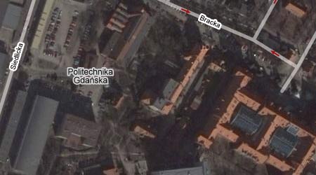
Google Maps has recently enabled both map and hybrid view for most of the Europe countries. This means that now they show names of the cities, streets and important institutions. And that, my friends, is great news!
Below, for example, is my alter matter. It’s not as colorful as it should be only because this aerial photo was taken during winter time (this past winter, I presume). It’s named properly in Polish (Politechnika Gdańska) and all the streets are there too:
(via Digg)

http://web.ics.purdue.edu/~cphartma/GBlast.html
http://reviews.cnet.com/4660-3424_7-6465847.html
http://koti.mbnet.fi/ojalesa/exam/newdual.html
http://www.google.com/mars/
That’s pretty cool, although the view of my mom’s house seems to be over a year old.